The Red G of San Marcello and the White-and-Red Sign Born in Maresca
What the big red G near San Marcello stands for, and how a 1950 meeting in Maresca brought order to Italy's hiking trails
What does the G in San Marcello stand for?
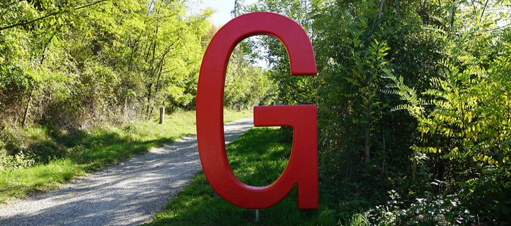
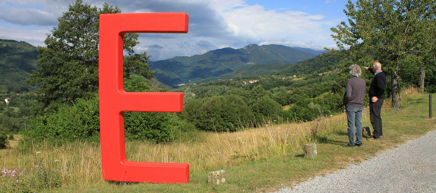
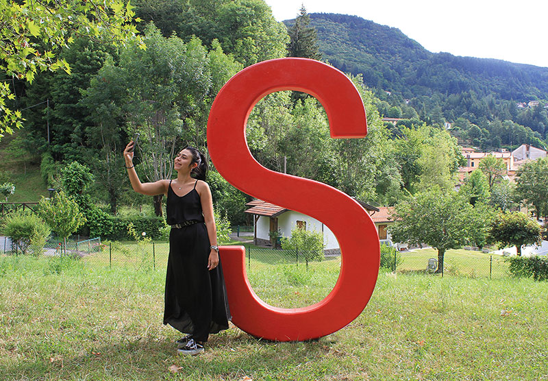
It is the third letter of SEGNAVIE, a trails-and-art project in the Pistoia Mountains: eight big red letters, each the initial of an Italian keyword (Segnavie e Sostenibilità, Ecologia, Green, Natura, Ambiente, Valori, Impatto, Ecosistema; in English: Segnavie and Sustainability, Ecology, Green, Nature, Environment, Values, Impact, Ecosystem) and placed at scenic viewpoints. The G stands for Green. It stands at l'Alberone, a little over a kilometre from San Marcello towards Gavinana, where the path of the old FAP (Ferrovia Alto Pistoiese) railway begins.
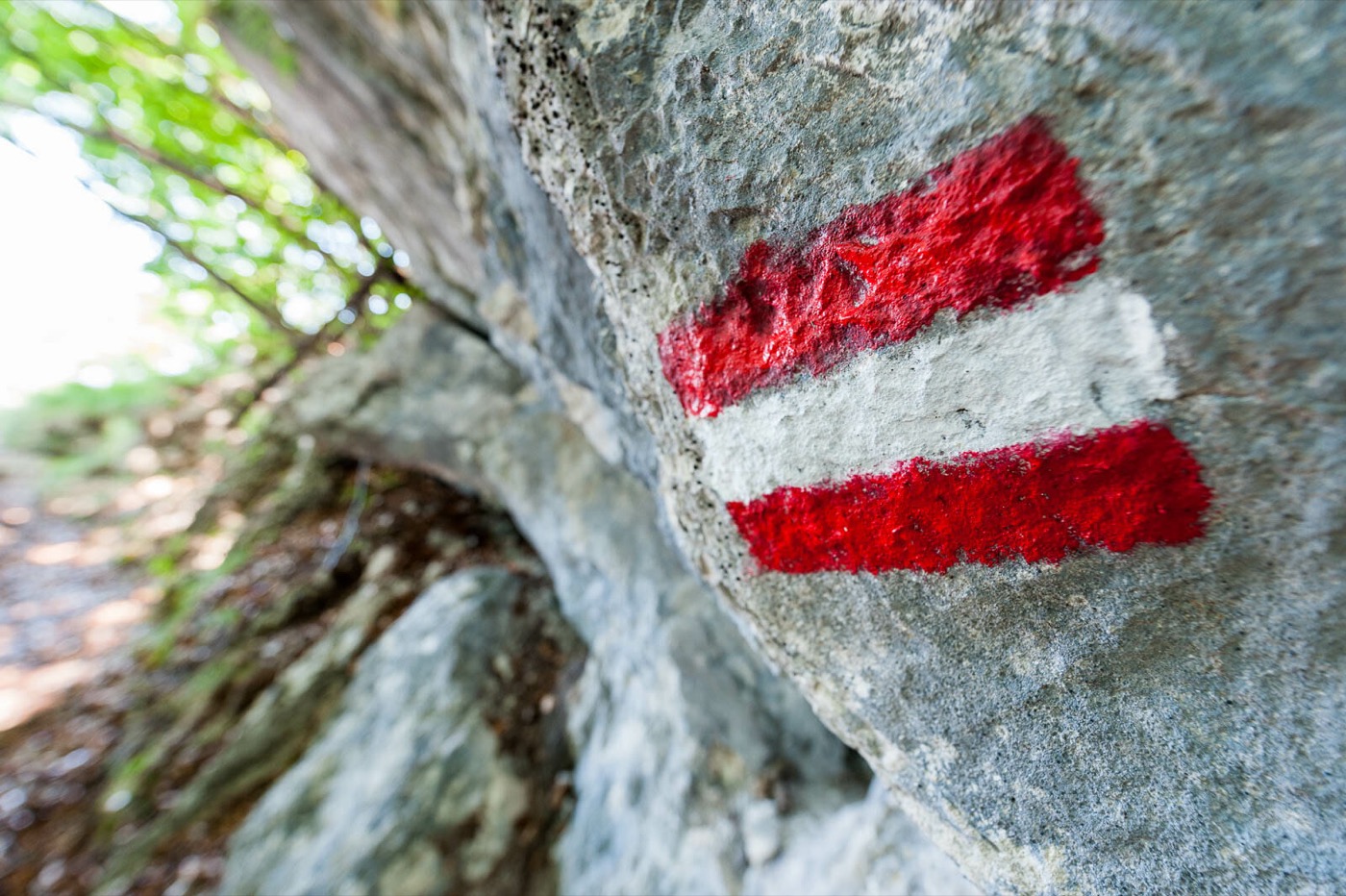
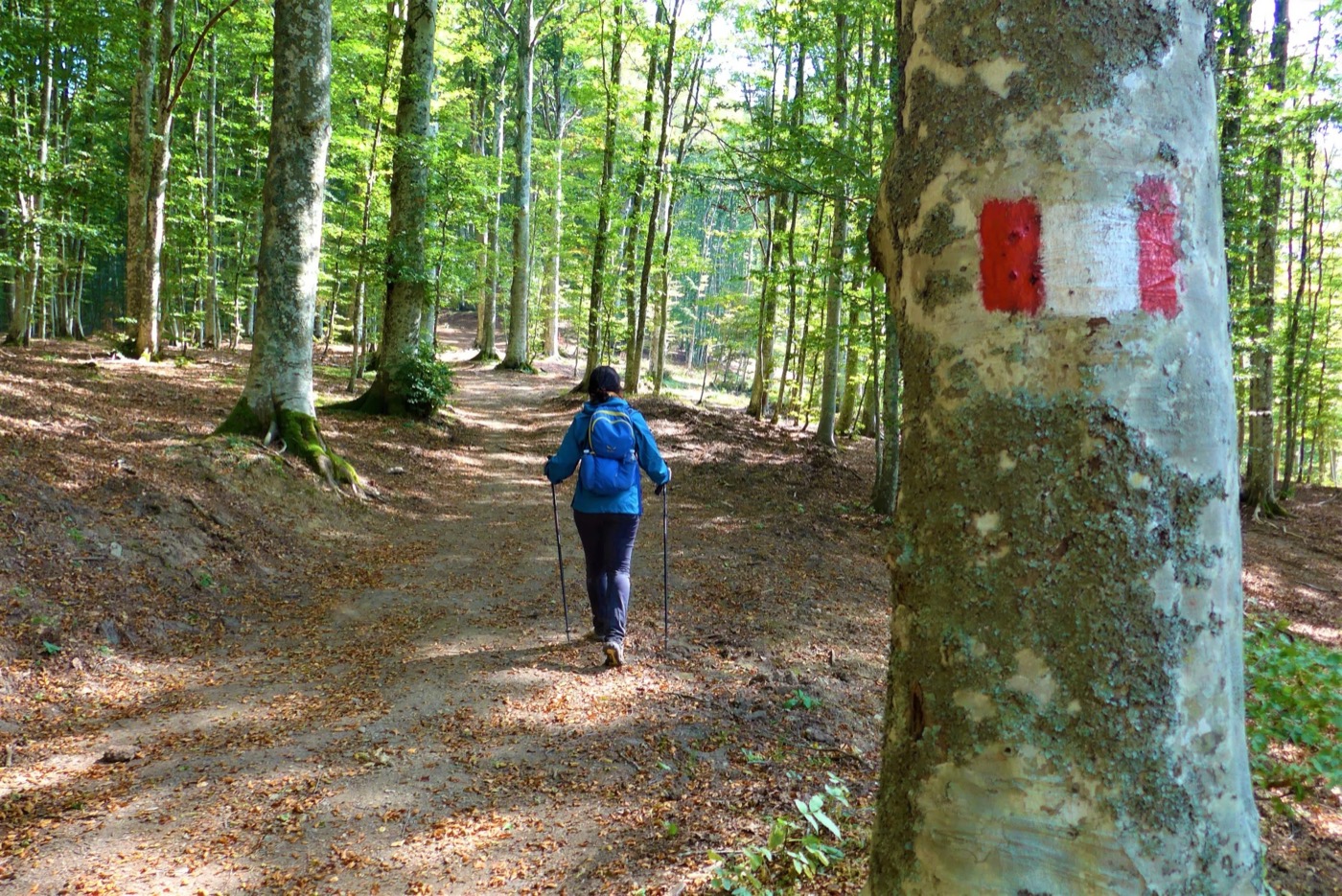
But why does a trail project use these signs at all? Because it all starts from a rectangle you already know. If you have ever walked an Italian hiking trail, you have seen it, the segnavia: two red stripes, a white band between them and the number of the path. It seems like something that has always existed. In fact it has a date and a village: 14 May 1950, Maresca, in the Pistoia Mountains.
The problem: everyone marked trails their own way
Before that day there was no common system. From the nineteenth century to the post-war years the sections of the Club Alpino Italiano (CAI) had marked trails each with their own colours, symbols and numbers. Walking from one valley to the next meant learning a new language every time, and in the Apennines, where trails cross the territories of neighbouring sections, the problem was obvious.
Four meetings in one year
The meeting in Maresca was not an isolated event. According to the account published in Naturart by Renzo Zagnoni and Franco Filoni, it went like this:
- 29 January 1950Preparatory meeting at Abetone.
- 7 MayMeeting in Bologna.
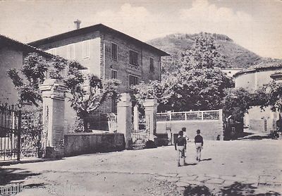
- 14 MayMain conference in Maresca, at the Pensione Mizia, with delegates from Tuscan, Emilian and Ligurian sections.
- 3 DecemberFollow-up meeting in Florence.
Names that recur in the sources: Mario Mori and the engineer Giovanni Bortolotti, both from Bologna, Francesco Cei from Livorno and Fernando Fini, president of the Maresca section. The system grew out of the practical needs of the people who walked the trails, not from an order imposed from above.
What they decided
The result went down in history as the Norme di Maresca (in English, the "Maresca Standards"). The rules, as summarised on the SEGNAVIE website:
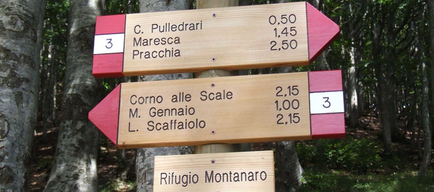
- a rectangular white-and-red trail marker, with the route number in black;
- the code "00" along the main ridge;
- even numbers on the Tyrrhenian side, odd numbers on the Adriatic side;
- the Apennines divided into zones bounded by the main passes, numbered from east to west;
- for winter, chestnut poles sticking out of the snow by about 130 centimetres.
And the money? That detail also says something about the times: the local authorities set aside very little, and on 3 July 1950 the representative of Pistoia asked for 50,000 lire to get started.
From the Apennines to the whole of Italy
The system was gradually adopted by the national CAI and spread across the entire country, the Alps included. Today we all use it without knowing, even with GPS and digital maps, and the work goes on: every year someone has to cut back the grass, clear the brambles and refresh colours and numbers.
And today? The SEGNAVIE project
Maresca has kept this legacy alive with SEGNAVIE, a project of trails and art created to promote the Pistoia Mountains. Behind it are local organisations (A.Va.M.P, Associazione Maeba), the Municipality of San Marcello Piteglio, the Union of Municipalities, the Fondazione Caript, Giorgio Tesi Editrice and the CAI. The idea is to link the valley trails, suitable for those with less experience, to the high-altitude CAI routes, dotting them with street and land art.
The network touches areas such as the Teso Forest, the upper Pescia valley, the Dynamo Oasis, the Macchia Antonini and the rural area of Piteglio and Popiglio. The current state is best put plainly: the project's website is online, but its content stops in 2022 (the last news item is the SEGNAVIE RUN race of 2 July 2022). On the other hand, according to the description of the July 2025 edition of the hiking map published by MapTrek Italia (Pistoia, Modena and Bologna Apennines), the SEGNAVIE network has been added to the map together with the new three-digit CAI numbering.
The eight letters, one by one
The project's map places them all. The letters are the initials of the Italian words, so in English they do not always match: the A, for example, stands for Ambiente, which means Environment. Following the ridge from Maresca towards Lanciole, each one has a reason:
Segnavie e Sostenibilità
In Maresca, the symbolic starting point of the ridge: here, in 1950, the Norme di Maresca were written.
Ecologia
Where the old FAP railway line crossed the municipal road. You can see the whole Limestre valley and part of the Lima valley.
Green
At l'Alberone, at the start of the former FAP railway path: from here you reach Gavinana, and San Marcello about a kilometre further on along the main road.
Natura
At Casa Luigi, next to the Dynamo Oasis visitor centre, on a terrace overlooking the Liesina, Lima and Limestre valleys.
Ambiente
At the Pieve di Migliorini, with the Lima valley and the village of Piteglio.
Valori
In the Macchia Antonini, at the edge of the avenue where the paths meet. At Ferragosto, by wish of the former owner, Mass is celebrated in the family chapel and the meadows fill with picnics.
Impatto
A monolith at Pian del Meo, above the hamlet, looking out over Cimone, Corno alle Scale, Gennaio and Spigolino.
Ecosistema
Above Lanciole, near the car park above the Pro Loco, with views of Crespole and the Val di Forfora.
Getting a feel for it in half a day
- Go to Maresca, where it all began: the S is there, the starting point of the ridge, and the village's artworks are worth a stroll.
- If you are short of time, start from the G at l'Alberone, a little over a kilometre from San Marcello, or from the N at the Dynamo Oasis: they are the easiest to reach from the centre.
- Look for the white-and-red trail markers and read the number: it tells you which side of the mountains the path comes from.
- If you fancy a walk in the woods, the Teso Forest is a few minutes away.
Further reading
- Renzo Zagnoni and Franco Filoni, "Le norme di Maresca compiono settant'anni", Naturart no. 36, 22 September 2020 (in Italian): https://www.discoverpistoia.it/le-norme-maresca-compiono-settantanni/
- SEGNAVIE, "Le norme di Maresca" (in Italian): https://www.segnavie.com/le-norme-di-maresca/
- SEGNAVIE, project and landmarks (in Italian): https://www.segnavie.com/progetto/ and https://www.segnavie.com/landmark-segnavie/
- Visit Pistoia, Maresca: https://www.visitpistoia.eu/en/tappe/maresca/
- MapTrek Italia, hiking map Pistoia, Modena and Bologna Apennines, 2025 edition (Avenza Maps listing): https://store.avenza.com/products/appennino-pistoiese-modenese-bolognese-ed-2025-maptrek-italia-map
Last checked: 2026-10-13. Original text by The Rooftop Terrace, written from the sources cited.